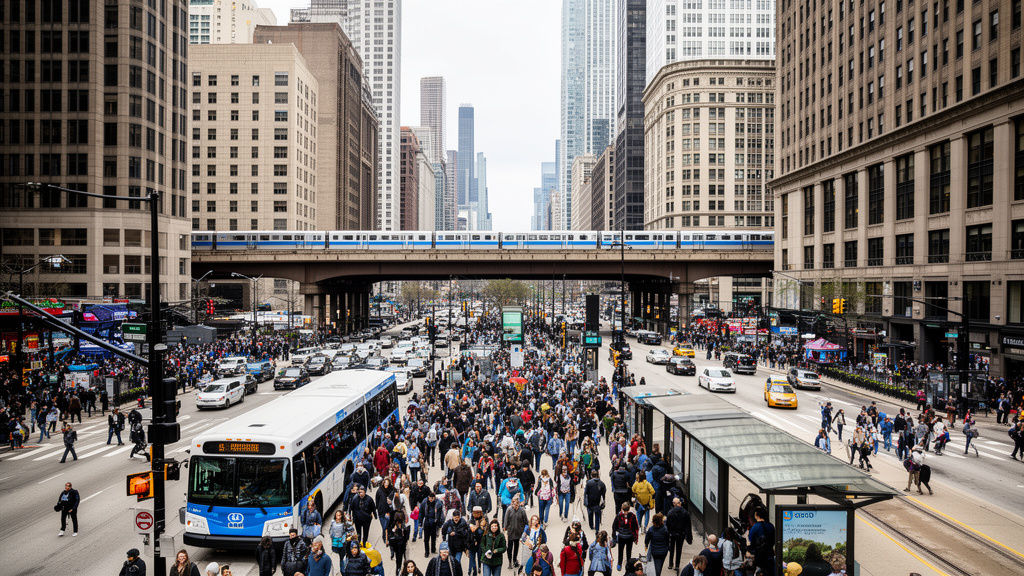
A potent storm system is currently pushing across the Chicago metropolitan area, bringing intense precipitation and a high probability of flash flooding. The National Weather Service (NWS) has issued urgent alerts for the region, noting that heavy rainfall rates—potentially exceeding two inches per hour—are causing significant street-level flooding and creating hazardous conditions for morning commuters and local infrastructure.
Key Highlights
- Active Warnings: NWS Chicago has activated Flash Flood Warnings across major sections of Cook, DuPage, and Lake counties, with the system tracking eastward toward northern Indiana.
- Precipitation Rates: Meteorologists are monitoring localized “training” storms, where heavy cells repeatedly pass over the same saturated ground, significantly elevating the risk of flash flooding.
- Transportation Hazards: Major expressways, including the Eisenhower (I-290) and the Dan Ryan (I-90/94), are experiencing standing water, leading to severe slowdowns and potential lane closures.
- Emergency Response: Local agencies, including the Illinois Emergency Management Agency (IEMA), are coordinating with the Chicago Department of Transportation (CDOT) to monitor drainage systems and low-lying underpasses.
Meteorological Impact and Regional Infrastructure
The current weather event is characterized by a low-pressure system funneling tropical-level moisture into the Midwest. Unlike typical thunderstorms that pass through quickly, this system is stalling, creating a high-impact scenario for urban areas. The Chicago metropolitan area, defined by its massive amount of impervious surface area, is particularly susceptible to these conditions. When rainfall intensity exceeds the capacity of city drainage systems, even short-duration events can lead to significant surface pooling.
The ‘Urban Heat Island’ and Storm Amplification
The Chicago urban heat island effect often plays a subtle but critical role in these weather patterns. The concrete and asphalt landscape retains heat, which can enhance convective activity within incoming storm systems. Meteorologists are closely observing how the city’s thermal footprint interacts with the incoming moisture plume. In some instances, this interaction can “squeeze” more precipitation out of a passing storm than would occur over rural, cooler environments, leading to the rapid water accumulation currently being reported in suburban municipalities west of the city.
Infrastructure Vulnerability: Lessons from Drainage History
Chicago’s historical approach to water management, centered on projects like the Tunnel and Reservoir Plan (TARP)—often referred to as the Deep Tunnel—is being tested by these high-frequency, high-intensity events. While TARP has been immensely successful at preventing sewage backups and mitigating large-scale river flooding, it cannot eliminate the risk of “street-level” flooding caused by overwhelmed local catch basins. As climate patterns shift toward these heavy-rain scenarios, city planners are looking at expanding permeable pavement initiatives and green infrastructure to augment existing drainage systems, highlighting a broader transition in municipal urban planning.
Economic and Commuter Consequences



The timing of this weather event has caused significant friction for the morning commute. Chicago serves as the primary transportation hub for the Midwest, and any significant degradation in road safety ripples outward. The impact is not merely a matter of traffic delays; it represents a tangible economic cost. Commercial trucking logistics, which rely heavily on Chicago’s expressway network for cross-country freight movement, are currently experiencing delays that cascade into supply chain efficiencies.
Furthermore, public transit systems, particularly the CTA and Metra rail lines, are bracing for weather-related disruptions. While rail tracks are generally resilient, signal failures caused by moisture intrusion or lightning strikes pose a secondary threat to service reliability. Commuters are advised to treat the day as a “high-caution” event, favoring public transit over personal vehicles to reduce the risk of becoming stranded in flooded roadways.
Secondary Angle: The Resilience Gap
While the immediate crisis is the flash flooding, this event highlights the “resilience gap” in older midwestern infrastructure. As these weather patterns become more frequent, the economic burden of mitigation is shifting from emergency response to long-term capital improvement projects. This raises questions about municipal budget allocations: how much should cities invest in climate-proofing against 50-year or 100-year flood events that now appear to be occurring with decadal frequency?
Secondary Angle: Future Predictions and Climate Trends
Climate modeling for the Great Lakes region suggests a trend toward wetter winters and more intense spring/summer downpours. The current system is a microcosm of these predictions, demonstrating how increased atmospheric moisture content is changing the nature of precipitation. Meteorologists are now factoring in more volatile saturation levels when creating models, moving away from relying on historical averages and toward predictive modeling that accounts for a hotter, more moisture-dense atmosphere.
Secondary Angle: Environmental Impact on Lake Michigan
Heavy rain events carry significant runoff from streets into the city’s watershed, ultimately feeding into the Chicago River and Lake Michigan. This runoff contains petroleum products, road salts, and other pollutants. During major events, if the system’s capacity is reached, there is an increased risk of combined sewer overflows (CSO), which can impact water quality. Environmental agencies are currently monitoring output levels to ensure regulatory thresholds are met, emphasizing the link between severe weather and public health.
FAQ: People Also Ask
Q: What is the primary difference between a flood watch and a flash flood warning?
A: A flood watch indicates that conditions are favorable for flooding, and you should prepare. A flash flood warning means flooding is imminent or occurring, and immediate action is required to move to higher ground.
Q: Should I drive through standing water?
A: Absolutely not. The NWS mantra is “Turn Around, Don’t Drown.” Six inches of fast-moving water can knock over an adult, and one foot of water can sweep a vehicle away.
Q: How does Chicago’s drainage system handle this much rain?
A: Chicago utilizes a massive system of intercepting sewers and the TARP (Deep Tunnel) system. While highly effective, it has a finite capacity, and in extreme downpours, surface streets act as secondary storage until the system can process the volume.